BBC News has a piece about railways running right next to the sea. All very fluffy and light but what really struck me were the maps. Here’s one:
What Colour The Sea?
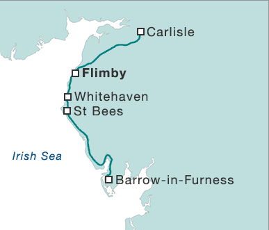
A detail map from the BBC, showing sea as white and land as blue/green
Note how they have chosen to represent the sea as white and the land as a blue-green colour (an equal mix—a quick check gives the colour as RGB(191,222,222)). That had the effect I spent a moment or two wondering when Carlisle had been flooded! The detailed view of Carlisle to Barrow-in-Furness line actually sits alongside an image of the whole of the UK:
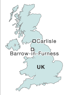
Green-Blue UK
The UK is much easier to identify in this colour scheme than a close up detail
In that image the familiar outline of the entire country immediately makes the land/sea divide obvious in a way which vanishes in the close up view. In short they’ve got consistency but no sense. Either that or there’s a tunnel going to Dawlish:
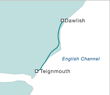
A Tunnel To Dawlish
BBC map tricking the mind into thinking the railways have tunnelled to Dawlish
Comments and Pings